Residents in burn areas should remain on high alert as Southern California prepares for what is forecast to be the heaviest storm of the season so far, and which could prompt evacuations, officials said Wednesday.
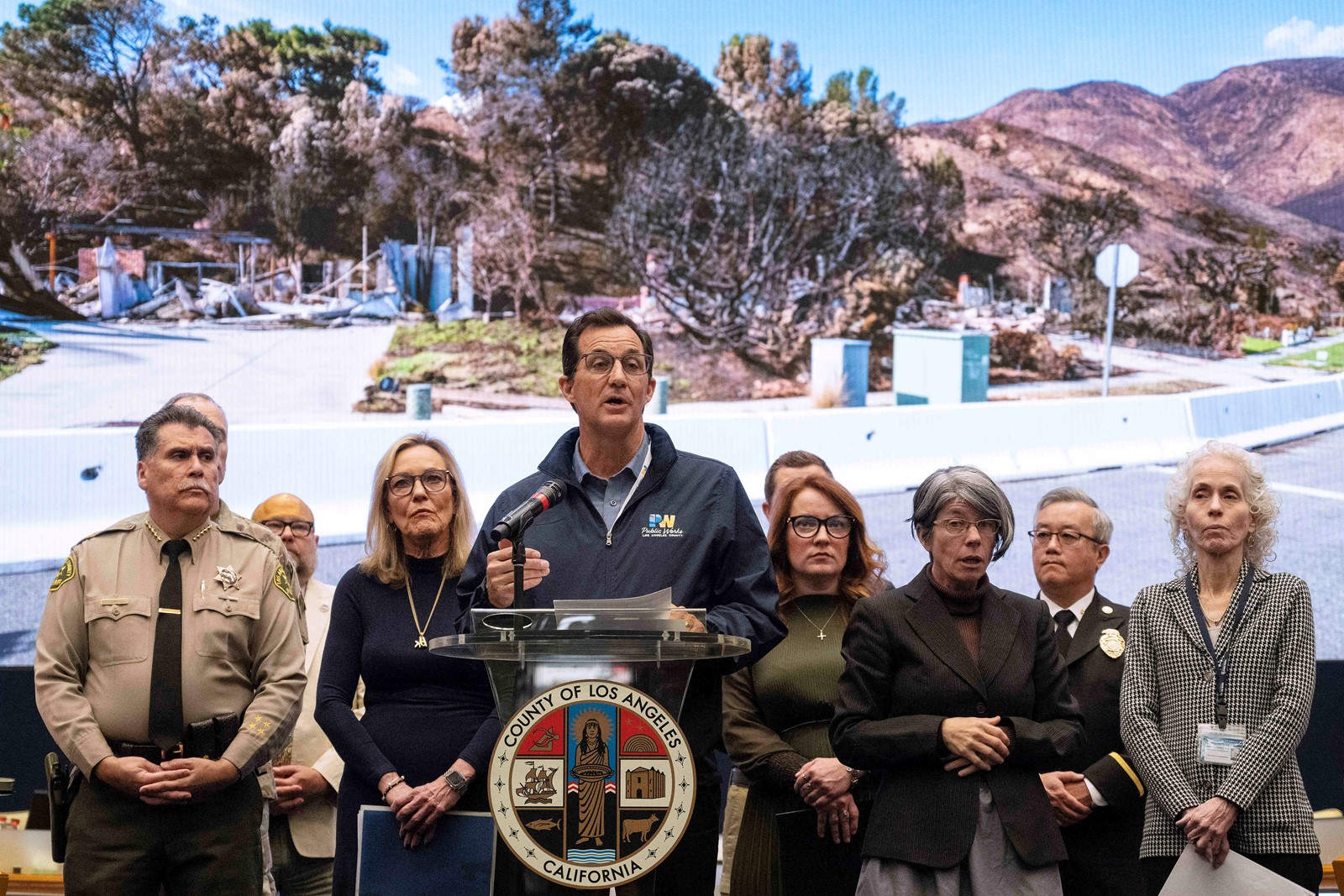
California and Los Angeles city and county leaders gathered to give an update on wildfire recovery, focusing on storm preparation ahead of the major storm that was expected to impact the area starting on Wednesday night and continuing into Friday.
“We have learned important lessons from previous fires, including the Station fire in the San Gabriel Valley Mountain foothills, where we saw the devastation mud had on homes in the La Cañada area,” said L.A. County Supervisor Kathryn Barger, whose district includes the Eaton fire footprint. The foothill communities will be at an increased risk this week from atmospheric rivers, so please don’t let your guard down.”
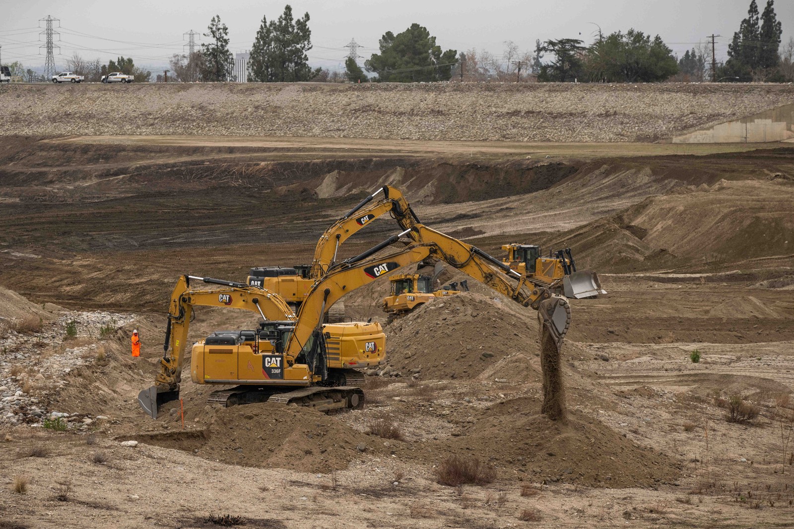
With the last rains, a debris basin near the Eaton fire burn area filled up, though it is once again ready to “take the storm,” and this rain event is even more intense.
The National Weather Service has issued a flash flood watch from this morning through the evening.
In the Inland Empire, areas of concern for flooding include Rancho Cucamonga, the San Bernardino Highlands, Redlands and Yucaipa — the areas between the 210 Freeway corridor and the foothills, according to weather service meteorologist Sebastian Westerink.
“Those areas that are sort of sloped on the foothills could see higher totals, 2 to 3 inches,” Westerink said.
These areas are not at risk for debris flow, but are of moderate concern for the weather service in terms of flooding.
But, much like in Los Angeles County, there is a risk of debris flow in burn scar areas.
“The Line fire burn scar is going to see rain rates potentially above .5 inches an hour, so there’s the debris flow risk,” Westerink said.
The heaviest rain in the inland area is expected to come with a cold front, between 6 p.m. today and 12 a.m. Friday.
The weather service provides briefings to partners like the Cal Fire and the California Governor’s Office of Emergency Services regarding probability of certain rainfall rates so the agencies can consider evacuations and personnel mobilization.
Mark Pestrella, director of the L.A. County Department of Public Works, emphasized that residents in any burn scar area from the past year are at an increased risk during the rain. Debris from slopes has been removed so that it will not clog systems like basins and dams when the storm comes.
“The flood control system is prepared. We expect an extraordinary amount of debris in certain portions of the streets and how we deal with that, is we have K-rail up. When the debris moves, we keep it in the street,” Pestrella said.
Everyone in a vulnerable location, which is homes in front of slopes that burned in a fire, has been contacted by Public Works ahead of the rain.
The upcoming and past rains have been factors in Pacific Coast Highway closing again after an initial postfire reopening.
Pacific Coast Highway is closed to the public between Chautauqua Boulevard in Pacific Palisades and Carbon Beach Terrace in Malibu due to concerns about possible mud slides or debris flows.
“We know, in particular, that the PCH closure is hard,” L.A. County Supervisor Lindsey Horvath said. “Residents may need to shelter in place. This is needed to ensure people’s safety and protect life.”
The closure affects many in Malibu, especially the Big Rock area, and Topanga, and Horvath says she knows it is particularly difficult for many students commuting to school.
“We want to open it up, but we only want to do so when it’s safe, so while this wet weather exists, we need to keep it closed,” she said. Horvath emphasized her support for Phase 2 of debris clearance, which began Tuesday. She said that for those who opted out of the U.S. Army Corps of Engineers clearing services, permits for private contractors to do clearing work should be issued starting today. As the Corps works on debris clearance, 6 inches of soil as well as the foundation of homes will be removed, so that fire ash and debris is removed, according to Col. Eric Swenson of the Army Corps of Engineers.
Sheriff Robert Luna said that Los Angeles Sheriff’s Department personnel are ready for the next few days of rain, with search and rescue teams in place, deputies ready to assist anyone in burn areas and others notifying unhoused individuals in flood risk zones to relocate.
In Altadena and the Lost Hills/Malibu area, residents who may be impacted by mud and debris flows have already been notified, and evacuation warnings were to be issued in those areas at some point on Wednesday, possibly followed by evacuation orders as the weather forecast becomes more precise, Luna said.
Luna said deputies have also been canvassing flood-prone areas such as the Los Angeles River to warn homeless people who may be camped there to relocate.
The rain has caused the Los Angeles Fire Department to put evacuation warnings out for several locations in burn areas from various recent fires. The warnings will be in place starting at 7 a.m. today.
In the Palisades fire burn area, the Getty Villa area, the Highlands neighborhood, Bienveneda Avenue area near Temescal Canyon Park, Reseda Boulevard/Marinette Road near Will Rogers State Park, and Mandeville Canyon above Tanners Road will be under evacuation warnings.
In the Sunset fire burn area, east and south of Runyon Canyon will be under an evacuation warning.
In the Hurst fire burn area, Olive Lane in the Oakridge Mobile Home Park will be under a warning.
Homes deemed high risk by fire officials will be under evacuation orders rather than warnings, and fire officials will contact those residents directly.
In another aspect of postwildfire recovery, the Board of Supervisors “took additional action to affirm (their) decision, increasing the penalties for price gouging up to $50,000 and enhancing (their) enforcement,” Horvath also announced. The Board voted unanimously for a motion to increase the penalty, meant to combat price gouging, something Horvath says no one should have to worry about in the aftermath of an emergency.
With more emergency alerts expected to be issued in burn scars areas threatened by mud and debris flows during rain, Kevin McGowan, director of the L.A. County Office of Emergency Management, addressed past issues with alert systems. False evacuation alerts were sent to thousands of residents during the January wildfires, prompting panic.
“We’ve been going through a mass notification process ever since the countywide alert went out and we’ve worked with the contractor to resolve all of those problems,” he said. “During that period of time we were using the California Governor’s Office of Emergency Services to assist us in issuing those alerts,” he said.
McGowan said the wireless alert system issue was resolved, but also suggested the public opt-in to county alerts. He said that while the county’s system has been corrected, they cannot guarantee that the infrastructure of their partners, such as cell service providers, have corrected their issues.
McGowan also said that a review is ongoing and findings will be presented in the future. A federal review has also been requested, Barger noted.
Rain was expected to begin on Wednesday, but the heaviest parts of the storm will hit Los Angeles tonight and Friday morning.
The Los Angeles County Department of Public Works was distributing free sandbags at the La Costa Post Office, 21229 Pacific Coast Highway in Malibu, for people in the Palisades fire area. For those in the Eaton fire area, the county was offering sandbags at Robinson Park, 1081 N. Fair Oaks Ave., and Victory Park, 2575 Paloma St., both in Pasadena.
A full list of locations where sandbags are available is at lacounty.pw/sandbags.
