One week after lightning sparked four wildfires across Colorado’s Western Slope, the efforts of hundreds of firefighters began to bear fruit Thursday with new containment and slower growth.
Colorado’s largest wildfire, the 15,000-acre Turner Gulch fire burning in steep terrain near the Mesa County community of Gateway, is now 9% contained, fire officials said Thursday.
To the south, firefighters increased containment on the 2,274-acre Sowbelly fire near Delta from 13% Wednesday to 16% Thursday. The fire’s footprint hasn’t grown since Monday.
Four of the five fires burning in western Colorado were sparked July 10 during a lightning storm. The cause of the Deer Creek fire, which started in Utah before crossing the Colorado line into Montrose County this week, is under investigation.
No containment has been reported for the three other active fires.
Together, the wildfires across Montrose, Delta and Mesa counties had burned at least 23,718 acres as of Thursday, cloaking parts of the Western Slope with smoke and prompting back-to-back public health alerts for air quality.
The most recent advisory issued by the Colorado Department of Public Health and Environment will run from 9 a.m. Thursday through 9 a.m. Friday in Montrose, Delta and Mesa counties.
Turner Gulch fire and Wright Draw fire near Gateway
The Turner Gulch fire burned across 1,000 more acres in Mesa County from Wednesday into Thursday, although fire officials announced the first containment since lightning started the fire on July 10.
As of Thursday morning, the Turner Gulch fire was burning on 15,071 acres with 9% containment on the fire’s southwest edge.
There’s been minimal growth to the north of the fire along Colorado 141, but fire officials have yet to declare that section contained, Operations Section Chief Brad Pietruszka said in a Thursday morning operations briefing.
The Turner Gulch fire makes up more than half the burn area of all the wildfires active on Colorado’s Western Slope combined. Extreme drought, steep terrain and hot, dry weather continue to challenge firefighters as the fire spreads, according to federal officials.
The Wright Draw fire, burning to the north across Unaweep Canyon from the Turner Gulch fire, did not grow from Wednesday to Thursday, remaining at 448 acres with no containment, fire officials said.
Both fires are burning along Colorado 141, which remains closed between 7.40 Road and 16.10 Road at mile marker 124, according to state transportation officials.
Bureau of Land Management officials on Thursday announced an emergency closure of public lands around Unaweep Canyon between Gateway and the north turnoff for Divide Road from Colorado 141 because of the fire.
Land surrounding Colorado 141 from mile marker 120 to mile marker 134 and the Divide Forks Campground area remained under mandatory evacuation orders Thursday, according to Mesa County sheriff’s officials. The stretch of state highway between mile markers 134 and 137 remains under pre-evacuation orders.
Deer Creek fire near Paradox
Increased cloud cover, light rain and less-erratic winds helped slow the spread of a wildfire burning on the Utah-Colorado line Wednesday night, fire officials said.
The Deer Creek fire is burning on 15,655 acres of land between Colorado and Utah, growing 895 acres since Wednesday, Utah fire officials said Thursday.
Most of the active fire is spreading in eastern Utah, but flames have burned 1,843 acres of BLM and U.S. Forest Service land in Colorado, fire officials said.
The fire crept into Colorado near Paradox in Montrose County this week, just north of Colorado 90.
Federal fire maps on Thursday showed that the wildfire was burning on a section of Colorado land more than 2 miles long and wide.
The wildfire was 7% contained Thursday, but that containment is on the Utah side of the fire.
Crews are using heavy equipment to create fire lines and aircraft drops to keep the Colorado side of the fire in check, and firefighters are stationed near Paradox to respond to any new fire starts, Utah fire officials said in an update.
Federal officials on Thursday announced an emergency closure of BLM land near Paradox and Montrose County’s West End for public and firefighter safety.
Rimrocker Trail at Q13 Road and Good Road, U5 Road at the turn for the Buckeye Reservoir and X2 Road all remain closed because of fire activity, according to Montrose County officials.
Difficult weather conditions capable of producing rapid fire spread are forecast to continue over the next several days, with afternoon thunderstorms and wind gusts up to 60 mph possible, fire officials said.
South Rim fire near Montrose
Firefighters battling the lightning-sparked wildfire at Black Canyon of the Gunnison National Park slowed the fire’s growth Thursday, with only 19 acres added to the fire’s footprint.
The South Rim fire is burning on 4,179 acres with no containment, according to federal fire maps.
Overnight cloud cover prevented crews from getting an updated infrared map of the fire, but those same clouds helped mitigate the fire’s spread, Operations Section Chief Tyler Nathe said in a Thursday morning briefing.
Mandatory evacuations remain in effect for nearby homes and trails, including the Bostwick Park area.
The national park remains closed to the public, with no timeline to reopen, and all campground reservations have been canceled for 2025.
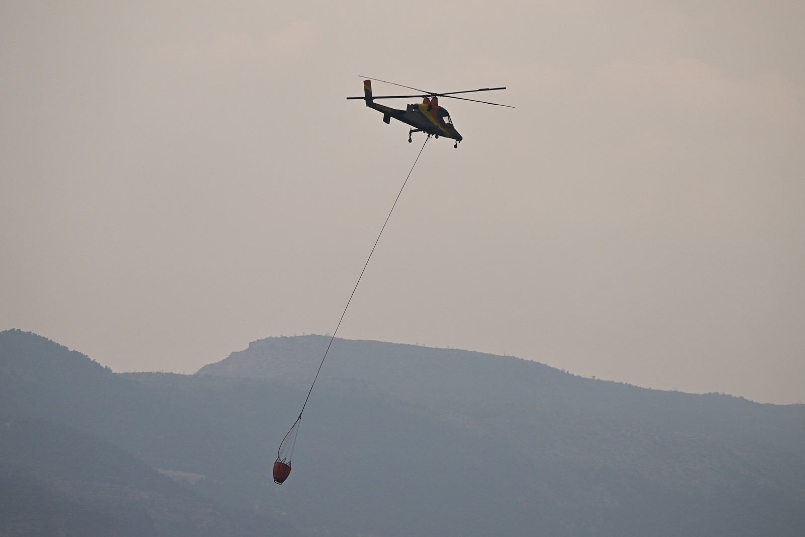
Resources fighting the fire Thursday include 458 people, 23 fire engines and five aircraft.
Curecanti National Recreation Area is open to the public, but the Blue Mesa Reservoir remains closed west of the middle bridge so aerial crews can access and use the water, fire officials said.
