SAN JUAN, Puerto Rico — Hurricane Erin exploded in strength to a Category 5 storm in Atlantic waters just north of the Caribbean on Saturday, rapidly powering up from a tropical storm in a single day, the National Hurricane Center said.
While the compact hurricane’s center was not expected to strike land, it threatened to dump flooding rains in the northeast Caribbean as it continued to grow larger.
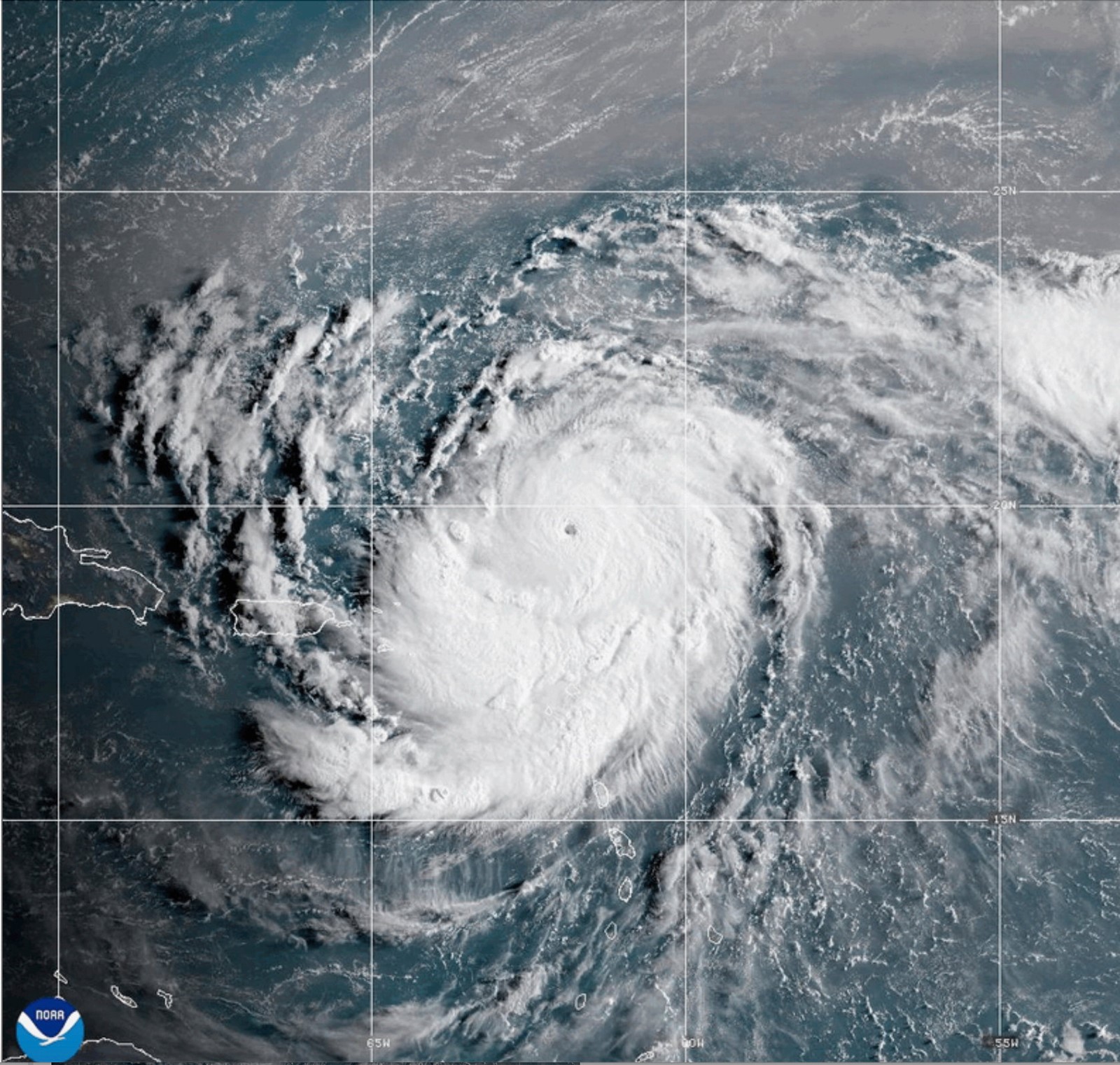
The first Atlantic hurricane of 2025, Erin ramped up from a tropical storm to a Category 5 hurricane in a mere 24 hours. By late Saturday morning, its maximum sustained winds had more than doubled to 160 mph.
Mike Brennen, director of the National Hurricane Center in Miami, said Erin grew into a “very powerful hurricane,” with its winds gaining 60 mph in about nine hours.
The Hurricane Center said Erin should begin to slowly weaken Monday as the storm encounters increased wind shear. However, forecasters predicted that it will remain a major hurricane until late in the week.
The hurricane remained a Category 5 storm Saturday evening, when it was located 135 miles northwest of Anguilla and moving west at 15 mph.
The storm’s center was forecast to remain at sea, passing 145 miles north of Puerto Rico, according to the National Hurricane Center.
Tropical storm watches were issued for St. Martin, St. Barts and St. Maarten and the Hurricane Center warned that heavy rain in some areas could trigger flash flooding, landslides and mudslides. The Turks and Caicos Islands southeast of the Bahamas were also under a tropical storm watch.
Though compact, with hurricane-force winds extending 30 miles from its center, Erin was expected to double or even triple in size in the coming days.
Powerful rip currents could affect the U.S. East Coast from Florida to the mid-Atlantic this week, despite the eye of the storm forecast to remain far offshore, Brennan said.
Hurricane specialist and storm surge expert Michael Lowry said that Erin had gained strength at a pace that was “incredible for any time of year, let alone Aug. 16.”
Lowry said only four other Category 5 hurricanes have been recorded in the Atlantic on or before Aug. 16.
The most powerful storms tend to form later in the year, with the hurricane season typically peaking in mid-September.
In October 2005, Hurricane Wilma rocketed from a tropical storm to a Category 5 in less than 24 hours, according to National Hurricane Center advisories from that time. Wilma weakened to a Category 3 hurricane before striking Florida.
And in October 2007, Hurricane Felix took just over a day to go from a tropical storm to Category 5 monster.
Including Erin, there have been 43 hurricanes that have reached Category 5 status on record in the Atlantic, said Dan Pydynowski, senior meteorologist at AccuWeather, a private forecasting company.
“They’re certainly rare, although this would mark the fourth year in a row that we’ve had one in the Atlantic basin,” Pydynowski said.
