Five wildfires continued to burn across Colorado’s Western Slope on Wednesday with minimal containment, although firefighters managed to prevent more large runs of fire growth and protected almost all buildings from damage.
The Turner Gulch, Wright Draw, Deer Creek, South Rim and Sowbelly fires are burning on at least 20,866 acres in Mesa, Delta and Montrose counties, fueled by extremely dry trees, brush and grass. Several of the fires are burning in rugged, remote terrain that’s difficult, if not impossible, for fire crews to access.
Extreme drought conditions mean firefighters are contending with some of the driest conditions possible, fire behavior analyst Glen Lewis said at a community meeting for the Turner Gulch and Wright Draw fires in Gateway on Wednesday night.
Although there’s normally a monsoonal season in on the Western Slope at this point in the summer, no significant rain is expected in the next two weeks, he said.
Most of the central Western Slope remains under an air quality advisory for wildfire smoke until at least Thursday morning, according to the Colorado Department of Public Health and Environment.
The advisory includes Mesa, Garfield, Eagle, Pitkin, Lake, Delta, Gunnison, Chaffee, Montrose, San Miguel and Ouray counties.
Mesa County’s Turner Gulch fire, which exploded in size late Monday night and early Tuesday, is burning on 13,984 acres with no containment, fire officials said Wednesday in Gateway.
The combination of extreme drought and high temperatures are similar to conditions on the deadly South Canyon fire, a 1994 wildfire near Glenwood Springs that killed 14 firefighters, said Lewis, the fire behavior analyst. Operations leaders are on high alert and are prioritizing firefighter safety, officials said Wednesday.
The Wright Draw fire, on the opposite side of Unaweep Canyon, is still burning on 448 acres, fire officials said.
The landscape around both lightning-sparked fires includes “unforgiving country” that makes it difficult or impossible for fire crews to enter or even plan around, operations section chief Travis Lipp said. There are at least 475 firefighters and other experts responding.
Fire officials are focusing on protecting homes and infrastructure and shoring up fire lines, and there may be some fire containment by Thursday, Lipp said.
Colorado 141 remains closed between 7.40 Road and 16.10 Road at mile marker 124 because of the fire, according to state transportation officials.
Land around Colorado 141 from mile marker 120 to mile marker 134 is under mandatory evacuation orders, according to Mesa County sheriff’s officials. The stretch between mile markers 134 and 137 remains under pre-evacuation orders.
The Deer Creek fire, which crept into Colorado from Utah, has burned more than 14,700 acres between the two states, fire officials said.
As of Wednesday morning, the wildfire was burning on 14,760 acres and was 7% contained. That’s another 1,800-acre jump from Tuesday, when Utah officials first reported the fire had crossed state lines.
Although it’s unknown how many acres the Deer Creek fire has scorched in Colorado, federal fire maps showed it was burning on a section of land more than two miles long and, at its widest, about two miles across.
The burn area is just north of Colorado 90 in Montrose County, near Paradox. It encompasses multiple county roads and parts of Ice Lake Creek and Lion Creek.
Dry thunderstorms and gusty winds fueled the fire’s overnight growth, fire officials said.
The fire has shut down Rimrocker Trail at Q13 Road and Good Road, U5 Road at the turn for the Buckeye Reservoir and X2 Road, according to Montrose County officials.
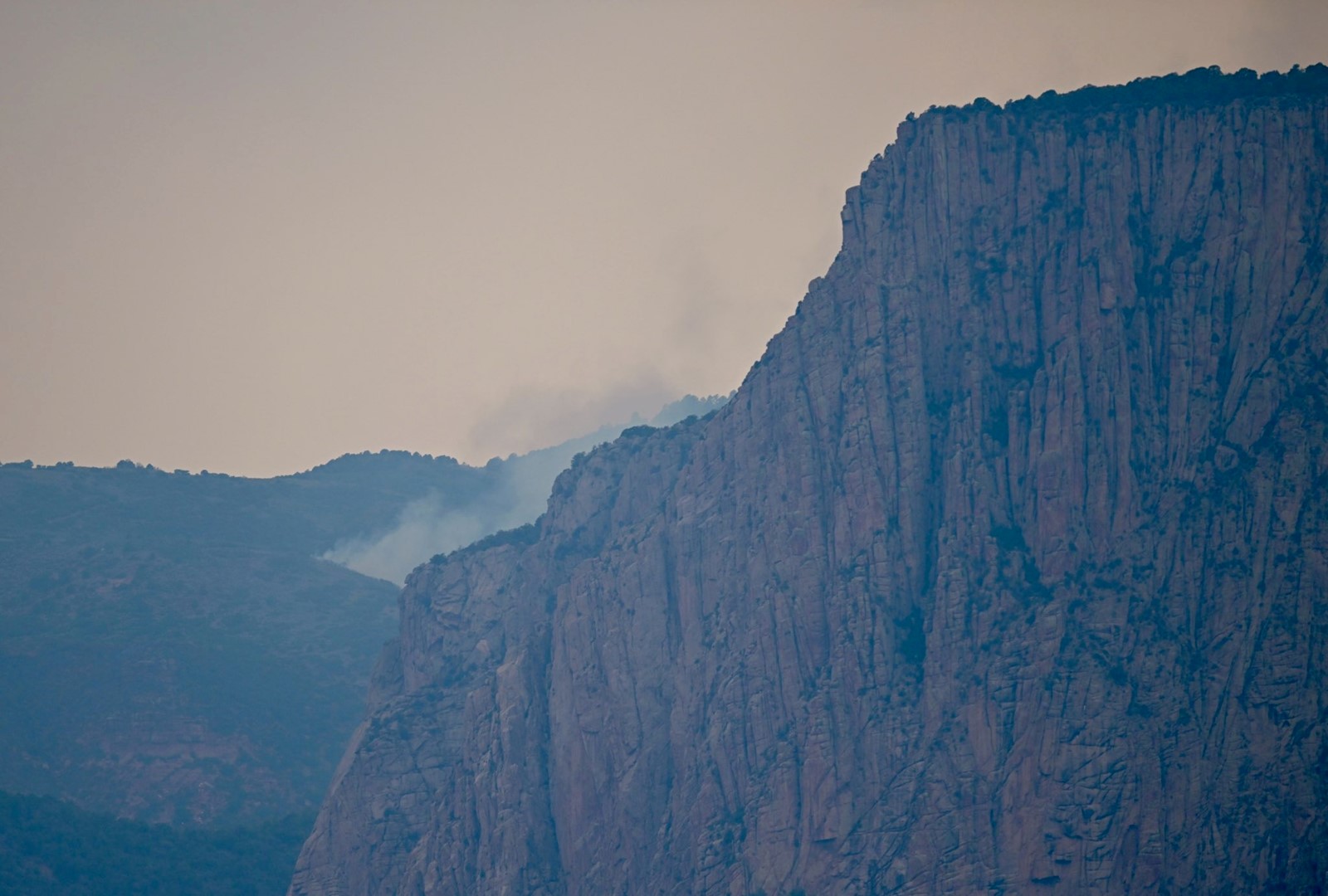
A wildfire that sparked in Black Canyon of the Gunnison National Park is burning on more than 4,000 acres with no containment, including most of the park’s south rim, according to fire officials.
The South Rim fire was last mapped at 4,160 acres in and around the park, Rocky Mountain Area Complex Incident Management Team 3 officials said Wednesday. Fire crews are making good progress on building fire lines and are focused on the western edge of the fire, although extremely steep terrain is making that difficult along the northwest side.
